Pretty much all of us here at The Broke Backpacker absolutely love to get our boots laced up and get out for a proper good hike. In fact I’ll wager that over the years we have hiked and trekked thousands of miles, across well over 100 countries.
So take it from us when we say that finding a good trail to hit can be tough. Tougher still, is exploring a strange trail in a strange place without getting too badly lost!
Well that’s exactly where the AllTrails app comes in. With over 450k trails worldwide and a huge community of users adding reviews and photos every day, it has become the go-to tool for hikers, runners, and outdoor enthusiasts looking for somewhere to go.
In this review, we’ll look at what makes AllTrails so popular, break down its features, weigh the pros and cons, compare it to competitors like Gaia GPS and Komoot, and help you decide whether it’s worth upgrading to the paid AllTrails Plus version.

The Broke Backpacker is supported by you. Clicking through our links may earn us a small affiliate commission, and that's what allows us to keep producing free content 🙂 Learn more.
What Is the AllTrails App?
Launched in 2010, AllTrails has grown into one of the most widely used hiking and outdoor apps out there, with tens of millions of users worldwide and trails in over 100 countries. Its success really comes from it being a community-driven collective work. Not only does AllTrails list ‘official’ trails, but it also offers user-generated suggestions as well peer reviews, ratings, and photos.
The app appeals to a wide spectrum of users. Casual hikers and families love its beginner-friendly filters and clear maps, while travelers like us appreciate its global coverage – you rock up in a new town in a foreign country and there is a fair chance the app will have a hike to recommend.
More serious trekkers might want to use it as a planning tool rather than a hardcore navigation system. But overall, its accessibility and worldwide database make it an excellent starting point for just about anyone who loves the outdoors.
Key Features of AllTrails
Trail Discovery & Search

To get started using AllTrails you can either simply open it up and let it suggest something nearby (provided your phone’s location sharing services are switched on, and working) or you can enter a specific destination into the search bar.
The latter is great for planning upcoming trips – for example right now I’m trying to find a few day/half day hikes for my visit to Uzbekistan next month so I’m searching “Uzbekistan” generally as well as “Samrakan” and “Tashkent” to really hone down on cities and regions.
But there is more! One of AllTrails’ greatest strengths is its search and filtering system.
You can find refind your search criteria to find trails based on:
- Difficulty, distance, and elevation gain
- Trail type (loop, out-and-back, point-to-point)
- Dog-friendly, kid-friendly, and stroller/wheelchair accessibility
- Seasonal suitability
This is in addition to searching for the type of scenery you want to see on the walk!!!
Oh, and while so far we have talked about AllTrails as a hiking app you can also search for Mountain Biking, running, scenic driving and more. We will kinda gloss over this side of AllTrails for now but by God it’s handy to have in your backpocket.
Of course, the proof is ultimately in the pudding here and an app like this is only worth using if it has an impressive array of trails to choose from. Well, using my local area as a baseline, I am pleased to confirm that AllTrails has come up well here and has plenty of suggestions. These include well known trails (the ones that tend to get blasted on a summer weekend) like Hebden Bridge’s “Hardcastle Craggs” as well as a few of my personal, lesser known, local-only favorites which I am not going to name here.
Heck it even had a few suggestions in my near-back yard that I myself had never heard of and which I am now going to try in order to properly test this app (keep reading).
Navigation & Activity Tracking
As soon as you open the app up you will see that it offers a “Navigation” option. If you switch to this, it shows you a nice overhead of your immediate surroundings. Right now I’m looking at my house, the canal that runs beside it and plotting out the fast way to the nearest pub. This is loadsa fun!
The app allows you to record your hikes using GPS, displaying your live position on the trail map. You’ll see elevation profiles, distance, and estimated times as you go. It also integrates with Apple Health, Apple Watch, Garmin, and Strava, making it very handy for those who want to log workouts or share activity stats.
So far, the Navigation is looking reliable and true to reality. When I first started playing with this app, I decided to leave the Navigator running and used it to track my journey across the town and home again. When I got back it had drawn a nice spaghetti doodle marking out my (somewhat haphazard) route very faithfully and offered information covering time taken, distance covered, pace and average speed.
Now as it happens, the step counter I have been using for years has recently turned to shit (ads more ads and questionable data) so going forward I am thinking about using this app to track my daily mileage.
Can I use AllTrails Offline?
OK as you presumably know, the point of hiking is to get outdoors and the great outdoors doesn’t always come with 5g (or any form of signal data at all for that). Even in a well connected part of the world like New York State or the South of England, a lot of nice day hikes have signal blackspots where you will be offline at some point or other.
As such, if you are relying on app you’re kinda screwed like?
Well AllTrails allows you to download your trail map and full navigation plan before you go meaning you have it in your back pocket when you get out of WIFI. That said, this feature is only available with the non-free, subscription versions of the app. We shall look at these later on.
Community Reviews & Photos
The AllTrails community is what sets it apart from generic map apps. Reviews and photos can provide real-time insights, like muddy conditions after rain, seasonal closures, or warnings about tricky sections.
In many cases, these firsthand notes are more practical than official descriptions.
You can also upload a trail yourself if you find something that you really want to share with the world. However note that you need to have a paid version in order to be able to do this.
AllTrails Plus & Peak (Paid Versions)

You can download, create an account and start using AllTrails for absolutely free. However for those heavy users who want to take things a step further there are x 2 different paid versions of AllTrails that offer a raft of extra features.
| What you get | Base | Plus | Peak |
|---|---|---|---|
| Plan for on-trail conditions | |||
| Build your own routes | |||
| Customise AllTrails routes | |||
| Explore community heatmaps | |||
| Download offline maps | |||
| Tour photos along the trail | |||
| Get alerts for wrong turns | |||
| Preview trails and terrain in 3D | |||
| Share live activities with friends | |||
| Find trails by distance from you | |||
| Print maps for backup | |||
| Go ad-free |
As you can see, with both paid versions you get the ability to download maps so you can view them offline when out in the woods. Personally though I think $50 a year is worth it just to skip the ads which can get intrusive.
That said, while I would gladly shell out for Plus, I feel that the only extra feature that really grabs me with Peak is the ability to build routes and I kinda have an uneasy feeling that in charging an extra an above premium for this privilege, AllTrails are maybe penalising their content creators.
Pros and Cons of AllTrails
Pros:
- Massive trail database with global coverage.
- User-friendly interface that beginners can navigate easily.
- Reliable for travel planning thanks to its international reach.
- Highly active community with up-to-date trail reports and photos.
Cons:
- GPS distance tracking can sometimes be slightly off.
- Free version is limited if you wanna hike offline.
- Some destinations better than others for trail options
Personal Testing Experience

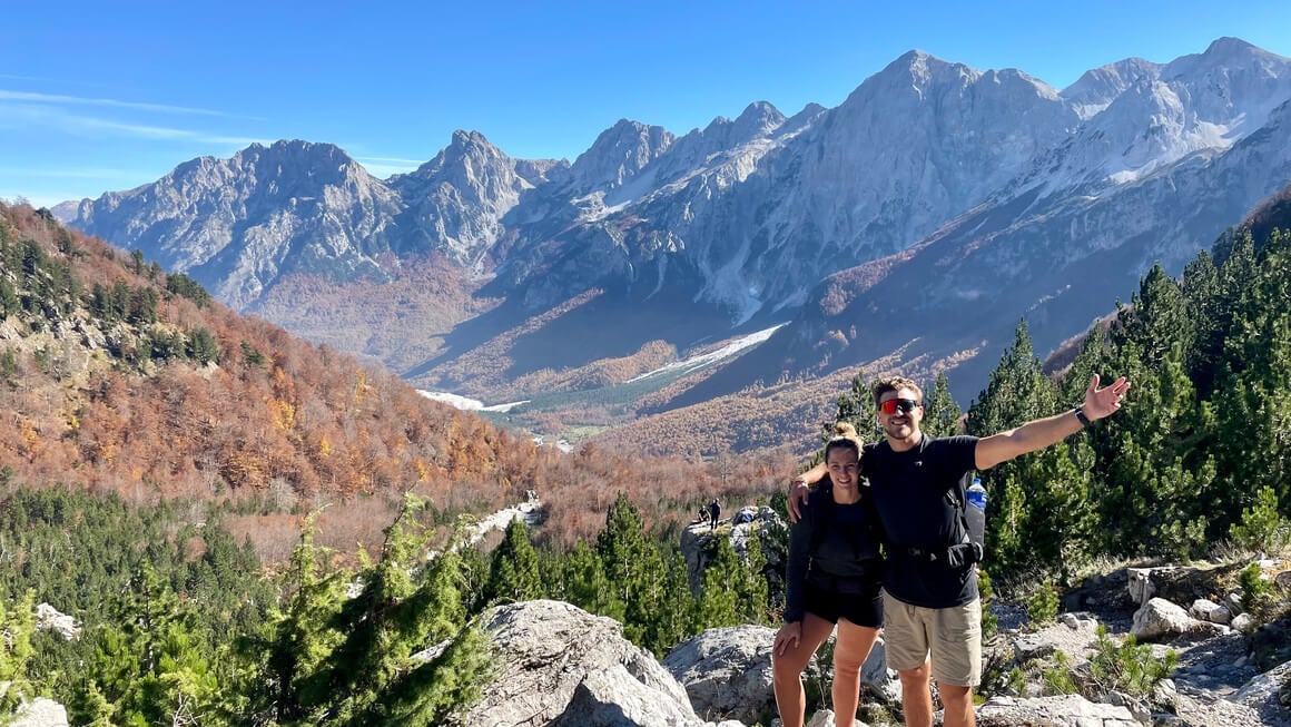
As mentioned earlier, I was pleasantly surprised by how many local hikes Alltrails seemed to offer including some that I was previously unaware of. As such me and my girlfriend decided to test AllTrails out for ourselves by attempting the Binn Green to Trinnacle trail on a late August day.
In case you are interested, the Binn Green to Trinnacle trail sits over the Yorkshire/Lancashire border in the general greater vicinity of Englands ‘true capital’ city of Manchester. We got to the trail head by way of 2 busses and then a 30 minute hike (the app’s map function helped us walk to the trail start point by the way).
Here is a brief summary of how I found the app;
Easy to Follow – The GPS-tracked route meant I didn’t have to second-guess any turns, even where the signage was sparse.
Elevation & Distance Tracking – I liked being able to check how far I’d climbed and how much further I had to go.
Offline Maps – I’d downloaded the map before leaving home (a must out here where signal drops out), and it worked perfectly.
Community Reviews – Reading recent hiker updates beforehand helped me prep for muddy patches after the week’s rain – had I not checked this I may have opted to wear my Nike Trainers.
All in all it made a great first impression and I look forward to trying it out again.
Who Should Use AllTrails?
- Casual hikers & families: Perfect for planning weekend walks and vacations.
- Travelers: Essential if you want to find trails abroad quickly.
- Fitness-minded users: Good for tracking hikes and syncing with fitness apps.
- Hardcore mountaineers: Might prefer Gaia GPS or a dedicated GPS device.
FAQ’s
Final Verdict – Is AllTrails Worth It in 2025?
So there we are. AllTrails has earned its reputation as the world’s most popular hiking app with good bloody reason. With an enormous trail database, a thriving community, and an easy-to-use interface, it’s perfect for beginners and travelers alike.
For most users, the free version is a great starting point. But if you plan to hike in remote areas or travel abroad regularly, upgrading to one of the AllTrails Plus accounts is well worth the modest annual fee.
Recommendation: Try the free version first. If you find yourself going offline often or craving extra features like wrong-turn alerts and 3D maps, make the switch to AllTrails Plus. It’s a small investment for a safer, more enjoyable outdoor experience.
See you on the road!